One would not expect to wake up with your manager's voice in your head genuinely asking what did you learn while on vacation. I did and I know it wasn't him rather my mind playing out on me. What did I learn?
.
First, some times last season's tools are need for a while into the next. My example here would be, knowing I was in a hip season between spring and summer, I should carry my traction aids, microspikes. Even around life, the tools I learn to use effectively last season, are need now.
.
Next, don't get off the plan. I set out with a detailed plan that was working for people going the opposite way when we talked about places and water sources. I got off track listening to them talk about snow levels and didn't steer myself back.
.
Third, don't let others get into your head and let their opinions about the hardships get you off track. Rather, ask them a few more questions directed back to the track wanting to take. Remember the plan. Who knows you may steer them back on track too.
.
Finally, this is the hard one to swallow, self talk is empowering or disempowering. I might have doomed myself from the beginning by looking towards the suck when I need to focus on the views, on the elation that comes from topping out on a hard climb, and the lessons of resource management in terms of water locations. All of those I just threw into a lump of suck.
.
All who know me and know me in passing, hiking is a passion. How many know that after 10 years of avidly pursuing, it's become a slight burden. The views no longer carry the awe, or the effort, the rewards. This is besides the point. It's good for me to share the photos so that I can hear from fresh eyes what I see. That helps recharge me. It helps me recharge knowing some are asking for what hikes I recommend in my home area.
.
Hiking is also an allegory for life, work, etc. If you reread the first 4 points one may see how my experience may tie into what is experienced by the reader. One thing I love about adventure literature is the over coming of obstacles. One may not draw business connections between the early Antarctic or Mt Everest expeditions yet, can see that those who over come have a leader, even self-leadership, that focuses on a positive out come and will work within the limits of what they have to over come that which was not prepared for.
.
Did I fail in the thru-hike? No, because I plan on coming back to it. I need an attitude adjustment. Am I learning the on going lessons of life? Yeah. They who stop learning are those that proceed to fail. I keep looking for that which I missed the first time around.
.
I hope this helps someone.
.
I continued to drive home without incident. That is, until I hit Salt Lake. Folks, please give each other room to stop! I witnessed a 5 car pile up one lane over and 3 car lengths ahead of me. I had to go through the debre field. Give space so that one distraction does not cause a cluster of other issues.
.
Well enough, at home, I'm cleaning, inspecting, and putting a way gear. Yes, it takes time even to put 15 lbs of stuff a way. This is the closing of my TRT journey, for now. I'll let folks know when I head out again. Thanks for the comments on social media and via this site.
.
Have a great holiday weekend and drive wisely.
.
Hike On!
Thursday, June 30, 2016
On the Drive
Wednesday, June 29, 2016
Vacation Day
Another long distance hiker camped next to me at Mt Rose, I asked him what could I have missed. He loaded up on water for the dry stretch ahead. His reply didn't come in the form of stuff but, in the mental game. Find the motivation with in, the next view, or a favorite jam on the tunes.
.
I drove around to Echo Lake where I sit now. Thinking, I could be done with this beautiful area. I found a trail marker with both the PCT and TRT symbols. The mental game. How did it hit me? Icy, fatiguing snow on day 2 coupled with three days of dry stretches, and the chaffing. The up hills wore me down too. I loaded my phone with music but, one item I forgot, ear buds. I think I'll throw a set into my food bag (I have plenty at home and none with me) so I won't forget them again. I knew about the suck. I even talked about the suck. I didn't realize how the suck would actually come. How can one be fully mentally prepared?
.
I think back on my AT experience. I can see how or why people drop out. Their mental game wasn't there. How then does one prepare for the mental game? How was I ready for it then? I'll look for an answer another day.
.
I'm chillin Lake side for now. No day hike gear with me. At this point, if I had it, I may go too big for the day. I see snow only way up there, the passes I fretted about now may be clear, than again maybe not.
.
I pass on. I play the tourist thing for a while. Stopping at Emerald Bay View. The road from there north is packed with cars in No Parking zones for an easy mile. I look at the beauty from the road at 35 mph.
.
Just inside the next town area, I see a backpacker, poles strapped to the rucksack with his thumb out. Viewing the gear from a distance I can tell the difference between homeless and hiker. I pull over. Through idle chit chat he tells me two days ago he got lost going over Dick's Pass. He stated he knew the area and kept going when he should have turned around. The snow still covered the upper reaches of the region. I dropped him off at the transit center in Tahoe City.
.
My doubts of bailing still play on me. The route I would have taken would put me on a treeless path up and over then sideways down a mountain. I can read a map and the terrain. I can put them together. I'm not sure how well over a long distance of what's required for Dick's Pass. With the trail being under the snow still, though it's been done by couples and with folks with GPS units, solo and without technology, I'm still glad I didn't carry on.
.
I turned up Brockway Summit and found some random narrow paved road. At the top is an old fire lookout on Martis Peak. Inside some drew the ridges coresponding to the matching view. Truckee airport to my south west, Twin Peaks to the south, Mt Rose not visible. Freel Peak to the east, snow covered. 1/2 mile below is where the TRT tags this road and then turns.
.
This hike is 4, 3 day weekend hikes strung together. Looking at my drive I can see points of better resupply and another layer or two of research into long distance hiking the need to find bus routes or Uber fares, the quality of grocery stores, etc. What surprises me is how different one area is from the next there is little uniformity. Would carrying 5 days supply be better than 3 and 2 respectively? Hum, how do each of the communities help hikers or other visitors? How did they set themselves up originally and how did they change when the times required them to? That's not a question for me to explore yet, gives inside to how different these communities are.
.
This campground is one of the few not overflowing. It's a gem 20 minutes away from the lake. The view for the walk in sites are worth while. As I write, now closer to dark, my area is filling up. I'll have the hum of traffic to lul me to sleep. It will be strange to put on cotton in the morning for the drive home. Clean clothes after a week of wearing the same. Did I tell you about my socks wanting to hike out on their own?
.
I haven't spent much time on the Internet. I see a thick layer of haze over Elko. Are there fires burning in California? When I get home I'll catch up on the news, for now I'll enjoy another cloudless sky with a bit of breeze.
.
Hike On!
.
Tuesday, June 28, 2016
Day 6, a debate
The family I thought were staying, didn't. It occurred to me about half an hour later that since Mom & Dad had hike the PCT and they ate dinner around 4 pm, they were busting out a few more miles for the day. This got me thinking, what am I not doing? I've counted my gear weight, weighed my food, and planned. I'm in good but not great shape yet by the end of my day, I'm spent. I've culled my gear list again. A few things crept into the pack at the last moment. Am I missing something fitness or nutritional? Is it not anything of the above but something in my head? Hum, points to ponder as I set out today.
.
What one may call lovely weather in the 70's and 80's, I call a bit warm on the mountain. I've got to remember this the Tahoe Rim Trail. Rim being the key word. I've got to hike up to the ridges and down into the passes.
.
Drink mix, that's what I want to add to my food bag. Plain water isn't so tasty now after coming from a creek, through a variety of plastics, and into a dry mouth.
.
I've stopped momentarily at Twin Lakes. Dry, bone dry. It's a field of grass with some granite boulders in the middle. Glad I topped off at Marlette's pump last night. I put a couple of tea bags in one for variety later today.
.
The debate still rages in my head about finishing now but, my heart isn't in it any more. The snow on my second day, on going dry spots, and one or two the things are weighing in on the finish another time. Would I say I failed? By any means, No. I've made some adjustments along the way. I've realized there's a few more skills to learn, and somethings to work on at home that will make the next hike, even a weekender, better.
.
I've noticed when I blog first my journal is dry. When I journal first my blog is dry. When I mix blogging into my day both are well accented.
.
I'm at Mt Rose Campground. I just cracked open my second jug of gatoraid, lemon-lime. Yesterday, I'd bought a small one for $5 iced or steaming hot and enjoyed it just the same. I've got most my gear spread out, inspecting it, and letting it air out. I keep thing what would I drop away? Sorry, the Emberlit does not meet my need. My tiny handheld radio is gone too. An extra spork, how'd that get in here? My red down puffy is on th balance. Yes, it's more than required for this week but, last week it was the right choice. I brought a bit of light reading if, you can Francis Schaeffer light. Clothing wise, one cannot beat DarnTough foot wear, err socks. Worn 6 hiking days strain and this morning they wanted to hike on their own. Not a blister on foot or crusty spot on them. I'm not sponsored by them, I Wil buy them over another brand for how they treat my feet. My Olympus camera didn't like my Goal Zero battery. I barely got here on one charge. Not bad but not as many photos either.
.
Gear, err, food. I'm eating bonelss chicken wings for dinner. Looking I to the future, less candy bar like food and more homemade stuff packed with more nutrition. Also make some that just needs water added, hot only if one wants a hot meal.
.
Couple of cool things happened enroute today. I meet up with the couple from Painted Rocks. They'd come through the Mt Rose Wilderness following in the foot steps of someone who knew the trail. Mt Rose Wilderness still had significant snow. Also caught up with the two ladies I meet south of Watson Lake. They skipped Mt Rose.
.
The debate is do I stay one more night and enjoy the area with a drive around the lake though 4th of July business is crowding the population areas or do I bail out tomorrow. Finally, do I call in for work next week or just take the full time?
.
I have some time to pick up one of the sections I've missed however, I'm raw from chaffing and really don't want to hike up another hill. Who wants to hike Mt Timp? I'm in shape for it and I'll do it with a day sack not the Cadillac.
.
This gatoraid taste good, second only to Marlette Campground well water.
.
Hike On!
Day 5, I'm thirsty
I awoke to something crashing around. I let it be for a while. I finally gave in, looking outside I see a big ol buck between me and my food bag. Since I was up I got up.
.
Packed some and the got out to the rocks for billion dollar sunrise. Fire from the horizon lit my sky and climbed.
.
Knowing I had miles, I got on the way. Down was nice. At Spooner Summit I must have missed a water pump some where for down to the lake I went. Gross! I've seen some nasty water but this I'll leave it at this goose poop refill. I spiked my water with AquaMira and got on the way. I do use the original Sawyer filter as my inline filtration. Dip and go, filter with each sip. Now, I want to add a carbon flavor filter, read on.
.
Tung sticking to my mouth dehydrated, I avoided drinking this water load I scooped. Eventually, during on of my breaks I broke out the Gator aid power chews and chewed while sucking on the water. At that same location is a patch of snow. I made snow angles and laid back til my back got numb.
.
I got on with it again. More of the same but this time down hill for 4 miles.
.
Got to Merlette Campground. Found a spot, and went looking for the pump. It was hard to move. I went looking for another water source. By the time I returned a couple of ladies had used limp balm to grease it. Water never tasted so good, cold, or refreshing. An official sign stated good to drink from the pump.
.
After they left, I cleaned up a little. And drank more.
.
I fired up the Emberlit stove for tea. Feeding the fire takes too long to boil water. If you want my honest opinion, message me. What I see for my needs may not be your's. If I express my opinion here it will not take into account of what your needs are. Also if you get a Chinese knock off of the SnoPeak pocket rocket, get 3. Try them and throw the 2 bad ones away. Guess why I didn't do when I got mine?
.
So I've been sitting around kicking back for a time. Chasing the sun with the solar panel and a jug of tea for tomorrow's hike out. I'm still debating if I go all out or fall short a mile or two and finish.
.
Even though today I've been thirsty, I've also wrestled with chaffing. Looking at the ridgelines around I can see my second day area is nearly clear and the same goes for the rest. I am good on time however just cause I can see clearing ridgelines does not mean they are. Chaffing over clearing snow is more for the factor. If you've never wrestled with this, you are lucky.
.
Looks like to night will be good around here. A small family is on the far side, a brother and sister are out before he goes to am Africa with the Peace Corps, and the rodents want our food. Speaking of food Knorr Sides of Stoganoff is on the menu.
.
Hike On!
Sunday, June 26, 2016
Day 4, A New Adventure
I awoke to predawn colors of the Tahoe Basin. City traffic reached my ears. I got up, packed, and headed down in search of breakfast. At the nearest grocery store I stopped to wash my face, grab a snack, and asked for the best breakfast joint. I was pointed towards the center of town. In retro spect I could have grabbed something there.
.
I found a coffee shop. Asked the batista what's good for breakfast. He gave a lame, 'I don't know' response. I got a big cup of drip and a breakfast burrito. The burrito Filling and the coffee, meh.
.
I grabbed the next bus towards Incline Village only to chat with the driver I was going the wrong way. He put me on a counter clockwise bus. Next thing I knew I was waiting at the end of the line for an hour for the Trolley. And connecting to another transit center to get up to Kingsbury where I plan to resume my journey.
.
This entry is choppy as I'm doing it in pieces.
.
After 4 buses, I got to sbury Grade and my resupply is not here. Thank you US Post Office for saying 'y3s, it's delivered' and the fellas at the Market said, 'who?'
.
I grabbed a couple of tacos, local style, from the Smoke House. Drop my belly off here. If I was to stay, the brisket would be plated.
.
Time to hike again, 2:30...
.
I'm rounding out today's adventure dry camping on the north side of South Camp Peak. Before I left one of the transit centers I topped off on water in a 1 liter gator aid bottle and the other two containers. Essentially I've got 3 1/2 ltrs with me between Kingsbury Grade and Sponer Summit trailhead.
.
The spot I have, how can I brag? I have a top floor hotel room with a billion dollar view. How I'm posting vis email will not let me post photos.
.
On my way here, I met 2 folks of the AT class of 15. And another couple. Both separated by a few miles. I relayed what I learned yesterday. They shrugged it off. From my view here, I can see Freeland Pass and it is anything but impassable without microspikes.
.
Even with this awesome view, I chose to eat a cliff bar and a single of spam. I know, I should be an ace in the back country culinary arts by now. I am enjoying a breeze which is Colin off the peppermint tea. My tent is out of the wind zone tonight.
.
In the mornin' I am so looking forward to this sunrise but I'm facing the wrong way. You put the heel of the shelter into the wind when possible. I've got a stunning still.
.
I'll head towards Merlette Lake 12 ish miles away and debate if I finish there or try to hike another 6 to get out of the State Park and camp. This particular place makes one stay at designated camp grounds.
.
What a day.
.
Hike On!
Saturday, June 25, 2016
Day 3
Day three is when the suck sets in. Everything is sore from the soles of my feet to my attitude. Granted at the first of the morning I was a mere 27 miles or so into it.
.
I came up to Watson Lake by 10:30. I thought about calling it a nero. After looking at the campsites, I chose not to and decided to head for a creek down a fire road near Painted Rock. That would give me, oh, 12 miles for the day.
.
Just south of the awesome view photo I posted on social media, I met some clockwise thru-hikers. They gave me the data on the next two sections of trail. Dicks Pass which is between Tahoe City and the PCT is impassable without microspikes. I'll need to pick up that section. At Painted Rock another set of clockwise thru-hikers said Freeland Pass was impassable. These two had met some PCT class hikers, meaning they had hiked the PCT previously. Okay, more detours to plan.
.
I did say Day 3 sucks. Well to add to the trail conditions, I missed the road with the water. I met 3 weekend hikers who said they'd just come up Twin Craigs. So short on water I asked the next set if there was water ahead. One described a spring next two two fire roads. I thought surely the weekenders had misplaced themselves.
.
I took photos along the way, found the water, and looked at the map. I'm a mere 1/2 mile from town. The plan now is constantly evolving. At first it was to head to Kingsbury Grade, pick up my Vox and hike North. I still have two days of food in my pack. I haven't eaten much in the last three days. Literally, the bag I had at my desk on Wednesday and a couple of Mountain House dinners.
.
Now I sit to dine on a Mountain House breakfast and sip tea.
Later, I'll look at the days I plotted for KG to Mt Rose. Can I SoBo on what I have or do I suppliment and return for my box before I leave. I'll need to pick up the southern half at a later time.
.
Yeah Day three sucks but I'd rather have it suck than everything to be ideal.
.
Hike On!
Friday, June 24, 2016
Snow Up High and Miles Below
I'd did say I hate wind, yesterday, right? Well the wind and I slept together. The for cast said it was to die down. It didn't until morning. The stakes held.
.
I called it early. I woke to a sky full of stars. The next time I rolled over the moon was out. I flopped to sleep on my otherside.
.
Morning came. I packed what I could what I could before having to actually get vertical. Once outside I made quick work if getting ready. What I didn't do was hydrate nor eat much. This would bite me later.
.
The slope I fretted about the night before went to nought as the trail cut a different set is switchbacks. Still took a while to get up the slope.
.
Most of the morning I spent relocating the trail from under the snow. I'd look for other foot prints, clipped trees, corridors of any kind. I was either on a Ridge or just below it, all above 9,500.
.
Needing water, since the next 20 miles are dry, I dropped into Grey Lake. Grey Lake is around 10,000. It's not even camp able yet for the snow. I got what I needed. I did say Lake of hydration and nutrition bit me, here it did. I took deep breaths, drank a little but not enough. Light headed, I knew I needed to descend. I got out of the bowl. Aimed myself towards trail looking territory and got below 9,000.
.
This section is dry. I got 2 1/2 litters. Initially for the day I was going to call it short of the highway but I chose to press on.
.
There's a utility project going on up and over Brockway Road. Pausing at the escort through this section I asked a mountain biker if he had water at his vehicle. I figured since he passed me going up, coming down was a sure bet he parked at the highway. By this time I was down to 1 and a bit litters. After the highway I've got another 7 miles before the next water source. Mountain biker dude, thank you.
.
I think I've pulled a 20 miler today. I'm beat. The snow crossings sucked from where's the trail to, I'm glad this snow has foot holds already. Then this dry section. Tip, drink before you get thirty.
.
Since I planned extra time on this leg for snow crossings and I'm done with them for now. I may take a Nero (low miles)at Watson Lake. I'll drink up before I leave there and camp outside of town before my first resupply day.
.
I'm gona enjoy a Mouthing House and a cup of tea now with my private view of Lake Tahoe.
.
Hike On!
Thursday, June 23, 2016
Day 1
Where do I begin besides leaving home before the traffic began to build for rush hour?
I got to Incline Village by 2pm so I hit the trail early. This is good as the camp ground I wanted to stay at still isn't open. I put an extra days rations I to my pack and left the car behind.
.
Some ladies coming down said they had to us GPS to find the trail in places. I have a map & compass.
I pushed through Galena Falls. And met my first trail junction. I stopped. Snow, not just a patch of snow but a trail full of it. I did my best to look for the trail in between the snow patches.
.
I decided to call it a day with plenty of day light left. I gathered some water for filtering. I gathered sticks for the Emberlit stove. I set camp in a rocky, poor holding tent stakes soil. I just found a few big rocks for the tent stakes. Did I say it's windy where I'm at? Yeah windy. I hate wind.
.
I started a fire quickly, adding sticks until my pot of water came to a boil. This took a long time. Just as I was ready to use it. I tipped it over... bawha! I ate a big spoon of peanut butter and a couple of tortillas instead.
.
Looking at the trail from where I'm at. Zoom in on the tracker and you may see a power line near by going to a communication tower. Tomorrow Begins finding some trail of switch back nature under patchy snow. Hence why I stopped here.
.
Maybe I should have stayed at the falls. It wasn't windy there.
.
Hike on!
Wednesday, June 22, 2016
Final Details
.
One or two little huge details also needed to be resolved. The itinerary is finally finalized. I'm sending it to the ground crew tonight. The final big concern, where to park, got tied up just yesterday. Google Maps, as awesome as it is, does not cover all. I played phone tag with one Tahoe area business which lead me to another which resulted in another call. The final call put me in touch with a group that runs a State Park off the Mt Rose Highway. Parking was a concern right feom the beginning. I gave this group:s representative my plates and dates. He also gave some final tips, thank you.
.
The attached photo gives good reason not to trust Google explicitly. This image is from a dirt track off of Sheep Creek Raod, Spanish Fork Canyon. Yes, I say this as I write a message on G-mail to post to Blog Spot, both Google products. The key here is never stop doing research and to use a variety of resources in planning, stay flexible throughout the entire process ready to adapt even while executing the plan.
.
My final, final items today will be to wrap up the ruck, pack the car, and to make sure I have not included any unplanned weight while not cutting myself short on needed items like fresh batteries in the SPOT and headlamp. Oh what else am I forgetting already?
.
Hike On!

Friday, June 17, 2016
Preppin
I'm checking maps, running web searches for Sierra snow level reports, playing with gear, etc about the only thing I haven't done is put myself on a strict diet and push myself into better physical condition. Soon, all to soon, I'll be on the road to a trail for a few weeks. Can you guess where?
On my web searches the photos of this trail are stunning. My north bound leg will share tread with the Pacific Crest Trail. I've got several friends from the AT on the PCT. I may not see them or if I do see a NoBo they may or may not know where my friends are. I looked seriously at a counter clockwise (CCW) hike to put me South Bound on the PCT to increase my chance of crossing paths with NoBo's. I want to find out more about their adventure beyond reading blogs and looking at Instagram photos. As I'm writing this blog, I may head the other way around. Out of Tahoe Meadows is MT Rose which I want to hit but not on my first day. I may take an extra day after completing the Rim. The counter clockwise route puts Watson in the morning, a stealth site for camp outside of town, and a resupply of 3 1/2 days with good water out of Tahoe City. Can anyone see my dilemma? Okay, I've still got time to hash out version 8, 9, and 10 of this hike. CCW would get me SoBo on the PCT and easier dry stretches with harder up hills. Umph!
I'm sure my immediate workmates are ready for me to be on the way or find another hobby. The Boots McFarland comics are definitely a good rendition of my planning and execution of this adventure. If you want to get notified of when I post, in the upper right corner of this page is a subscription link. I haven't figure out how to link Instagram to feed into Blogger's format. If you aren't on Instagram, no worries, it's another social media feed which resembled an older version of Flickr. I plan on writing every few days and for personal security post later. My parents will know where I am at thanks to their little friend, SPOT, a satellite beacon I carry.
My pre-hike jitters are long gone. I'll admit, I am already looking forward to the next long distance hike. Things I am considering are other two to three week ventures, mainly late spring or early summer, resupply options. I want to some how career track hiking along with work along with other things of life.
I recognize I mention other things in my last post. There is a church out of Kalispell MT that wants to bring a campus to Utah, FreshLife. There are also other solid Christian churches in Utah as well as other remote campuses. If one church does not fit your style, look for another. As I hike I realize my style of hiking is not for everyone. I enjoy sharing by writing. I did not get here by saying, I am a long distance, light weight hiker. I got here first by being introduced to hiking by my Dad, Happy Father's Day. Thanks for getting me out and about. Then I was introduced to backpacking in Cub Scouts but, I really contribute it to a friend's Dad who took us to Grand Daddy Lake in the High Uinta's as Boy Scouts. This hiking life is a progression. Don't let anyone or anything hold you back from exploring the mountains, career, or faith. The Trail will provide and when it doesn't one adapts, it's the same with life.

Sunday, June 05, 2016
Loop Time
A discussion with a work mate on Tuesday made me glad I hadn't gone to the Uinta's. A quick look at the forecast and at the maps, I decided to head up to, rather down to Sheep Creek Road and do a 20 mile loop in preparation for my vacation. It'll be good.
Since I went to a Singles BBQ, I hit the road and on to the southern end of Sheep Creek around 9 am, it's a little more than an hour away. I parked at Second Water, hike down to Fifth Water Trailhead, up passed the hot springs (complete with dogs in the water) passed a few more water falls, and across Sheep Creek Road. I stopped for lunch. Looking at the map and the time, I decided to press on.
At the top of 5th Water, I turned south towards 2nd Water. 5th and 4th Water canyons had good spots to camp but I decided to see what it took to do a long day. Along the south bound portion, I played leap frog with a family of Trail riders on motor cross bikes. Eventually they passed me for good.
I took a break at all the creek crossings on this leg. Made good time. Ironically, I'm at the same site I was last weekend. Tomorrow's a short day maybe 2 miles to the car. By my estimate, 18 miles today. I chose not to stop at the hot springs to soak, also bathing in sulfur infused water is not my thing. I like my miles.
My thoughts today are not on the chafing, side note don't use hand sanitizer to clean that stuff, nuff said. I'm sure there is a warning about rubbing it over chapped skin somewhere . Thoughts aren't on the vacation, which is rapidly approaching. It's on something completely different. A Christian Church from Kalispell MT wants to plant a church in SLC. I am a Christian. I served as a missionary, cooking for a particular sea going organization, for many years. I asked on of the team members from MT, why SlC. His response 'an area can never have to many churches' I stayed for the rest of that interest meeting. I've gone to a few more meetings. Would my readers mind if I added more to my blog besides hiking and more hiking?
Sorry about not following through with the last entry of doing an out and back on the Great Western.
Sunday, May 29, 2016
The Great Western
It's Memorial Day Weekend, looking at the weather all week at work drove me a little nutty. Rain/snow at 40% chance in the Uinta's or rain at 20% south of Utah County. Even late Friday I didn't have a clue. I swung by an outfitter for a map of the southern Wasatch. My target became anything off Spanish Fork Canyon aka Highway 6. It's an hour, odd, drive and if I see a bunch of snow there I can day trip it and be comfortable.
The Great Western caught my eye. I've searched the internet for anything on this trail. It lacks, horribly. I saw I could hike north or drive south. I hiked north. The GW isn't all hiking, one can go off highway vehicle style in many areas, hitch a horse, and even drive a car.
I turned in at a rest stop to check my map and sure enough I was 1/4 mile from the trailhead. I thought about driving up the dirt road however, the first stream crossing looked more like a jeep adventure. I chose instead to park and hike.
7 stream crossings total as I got on to single track dirt bike territory. I followed up to Strawberry Ridge. Thinking, so this is why my Dad likes to hunt around here. Rolling hills, loads of sage and Aspens, perfect for a big buck. By the way, he hasn't gotten a deer for a few years.
Knowing this is my first time out this summer, every mile I hike out, I have to come back. This trail doesn't make any loops. I also kept an eye to the sky.
I stopped for water at Second Water creek. It was the first good flowing stream in 6 miles. The meadow looked good for camping. I headed to Third Water Creek and noticed nothing but hammocking sites. I'm on the ground this weekend. I looked at the map, noticing there would not be much ground dwelling sites for 3 or more miles, I doubled back.
At the top of an unnamed rise, I dropped the ruck and took a side trail. A top the mountain (?) I saw Mt Nebo to the south, Mt Timpanogas to the north, and potential communication towers in between. My phone was in the ruck, arugh. On my way up I caught a moment glance with a bulk elk in velvet.
I took my time getting to the meadow noted before. When I did I scoped a spot out and set camp, cleaned up and did some writing. As I finished my supper of crunchy knorr side garlic noodles with a side of Caribbean spiced tuna, a couple of runners came up the creek. It's 1 1/2 miles to the nearest road.
Besides a lazy afternoon, I set out a solar panel to recharge a device that goes flat just by looking at it. This is a small hand held ham radio. I scanned for any 2 meter contacts then for a radio station. The first station was Local Satilite Christian radio. I left it there and enjoyed some older radio worship tunes.
Tomorrow, I'll reverse my direction, put the sandals (Xeroshoes)for the creek crossings and possibly head south, camping along the road side.
For now, I see a little gold on the hill above and pink in the clouds. I ready for rain and more so to stretch out to sleep.
Tuesday, May 03, 2016
Bell's Canyon Falls

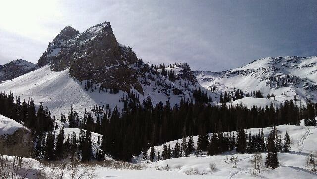
Saturday, March 19, 2016
Quick
Three others on skis were grabbing a snack before they headed up a skin track to one of the chutes above. Three others were nearing the top.
Years ago I chose not to get into backcountry skiing. This area is wealthy to opportunity of terrain. I'll add, too, avalanches. From where I stood, I counted three recent slides. Two of which are naturals coming off rock faces above, not from where someone would ski though. The third was a wet sluff from a few warm days ago. My route to this spot never crossing a run out path. Broads Fork is nice in that regard.
On my way down I crossed paths with someone I've met several times before. He's into mountaineering which will take him and his friends up through avalanche zones up to the peaks high above. Later I crossed paths with another friend about a mile up the trail.
Arriving at the parking lot I glanced at the time, 11:20. I'd been on the trail three hours, about five miles and 2700 feet elevation gain. That was quick considering I had actual hiking boots on if I need to use the snowshoes and simply for being on semi punchy snow. Quick and well worth it this morning.
Friday, March 04, 2016
Spring update
For those who've expressed interest in my blog from work, thank you. I know work is slow and it was while at work that I did most of my planning for the Appalachian Trail.
I will admitt over the winter I slowed down my hiking considerably. I did get out, just not as often. My most hiked trail was Dog Lake in Big Cottonwood Canyon. It's quick and easy without a lot of avalanch danger. Another hiked trail is the upper Millcreek road. I do like Millcreek however it does get over run by doggie poo bags. Please when you walk you pup remember to take the waste with you. There are some things I will pack out, like campfire trash and candy wrappers.
My plans for the up coming hiking season is to thru-hike the Tahoe Rim Trail [TRT]. I'll get back up to Anderson Pass, this time with cool weather gear to finish King's Peak. There are a few lakes in the Uinta's I want to get back to including Four Lakes Basin (south slope), Naturalist Basin (south slope), and Red Castle (north slope). I'm not much of a fisherman, though I grew up fishing. These lakes are remarkably stunning and will be worth the nine plus mile hike in.
The TRT is a quick 2 week hike with 3 resupply points wrapping around the mountains surrounding Lake Tahoe CA/NV. At 165 miles some of it shares tread with the Pacific Crest Trail on the western side. I first read about the TRT in Backpacker Magazine a few years back. For it's short length it makes a nice, don't quit the job thru-hike.
I wanted to hike the TRT last year however, the temporary position I took at work made me hang the plans up for a season. I'll say cyber-hiking isn't like tread on treadway, I managed. I'll also say the position stretched me in ways of interacting in a training environment pushed this flip flopping intor/extrovert around in good ways.
I'll be digging up some links for the side bar, updating the photo slideshows too. I may not do a GPS tracker except for a select few for saftey. My tab pages are also getting a work over too.
As for now, look at the weather, toss on another layer, and hike on.
Wednesday, September 09, 2015
Henry's Fork
Henry's Fork, on the Uinta's North Slope is the quickest way into King's Peak, Utah's tallest mountain. I'm not much of a peak bagger. I like to hike. For some reason I wanted to hike up to this mountain.
Two weeks ago some work mates stopped me from taking Labor Day weekend early. This weekend I got it right. I packed my ruck a little lighter then three weeks ago. Base weight close to 10 pounds, add 5 for food, and 2 1/2 for water. Close to 20lbs without sacrificing safety.
I monitored the weather all week. Wind warning through Saturday morning. 30% chance of rain on Saturday afternoon and evening. Clear the rest of the weekend with lows near 30 and highs near 50. Not bad for the region and definitely weather mosquitoes don't thrive in.
I got up early, headed out, missed my turn which cost me an extra hour driving. I also learned, local gas station help no longer know their areas.
On the trail, miserable hikers came down cussing the weather of the week. Many for went going over to the King's Peak summit trail. I stopped just after 3pm beyond Dollar Lake. Way early however the rain came through in waves of short passing clouds. The temp also dropped.
I pitched my little shelter. Wandering in between flurries. No snow but, did have hail one time. That evening I met some fellow campers just up the way.
The night dipped into the 20's, my 20 degree quilt did fantastic, I didn't, I had cold spots. One item I left behind was my thermal bag liner. It's re-earned its position in my pack. Same with my 1/2 litter bottle, aka coffee mug.
In the morning, I made 20 minutes from letting out the air in the pad to being on the trail. I wanted to make coffee at the top of Gun Sight Pass. Below the pass I changed my mind and left the pack. Taking only some lunch and water, I headed up.
The wind bit through my rain shell. I dropped into Painter Basin and around to Anderson Pass. At the top of Anderson, I caught up with the guys from the night before. A cold wind tore through me. They offered something to eat and since I don't turn down trail magic, I ate. They headed up the summit trail. The wind and I were on other terms.
I rounded back the way I came. Sat at Gun Sight for a while, now about noon thirty. My secondary plan was to complete the Henry Fork loop and camp near Bear Lake.
The loop, amazing, okay, this whole region has me asking myself why haven't I been here sooner. The south end took a little trail finding as I crossed several wet meadows. The rest well defined. At Bear Lake I found a great camp site however, it's too close to the trail and near a large body of water. The later being the deciding factor as water equals colder nights.
I moved on. The North end had no campable terrain. The next area had no water. Finally at Elkhorn Crossing, tired of walking all day and the time near 5:30 I sought out a place out of sight of the trail and in between live trees. The area has hundreds of dead standing firs.
I got water, made dinner, and went for a wander. The side trail I used to find my spot in the woods is an animal trail. Hum, what else besides moose use it? On my wander I did see a moma moose and a calf.
I watched hikers make their way down the main trail while I ate. All were focused on the trail not in looking around. I'm also just a few meters in from a huge meadow that stretches near a mile up into the valley.
The next day, I had an easy out. I thought about making coffee if I'm not super cold. I checked the weather frequency and 30's with partially clear sky, light wind if any.
On the drive home I decided to re trace the route Google offered. I got Googled. I retraced my route deciding next time to look at the maps and not rely on Google's directions.
Monday, September 07, 2015
The Rest of the Over Nighter
After wandering down by the lake with my supper, I returned to set my bed for the evening. The Gatewood Cape affords a tight 7x3 space.
I soon found out reading while sitting is highly inconvenient, so is laying down and reading. Before I knew it, I dozed off with the book in hand. I quickly put it away when I woke 20 odd minutes later. I reached around adjusting a few items and returned to sleep.
Waking up periodically while in the backcountry is no different than at home, except I got stars right above me through the trees. One time, a flash of lighting woke me seconds before the rain came. I undid the button holding back the door, zipped it, and waited to see how the cape would hold off the rain. It did just fine, less two spots that I'll seem seal another day and the fact that SIL, silicon impregnated nylon, lets a little rain through in the form of mist. I fell back asleep counting flashes and booms. Only a few spooked me close but, no closer the other outings.
In the morning, the rain leaving satter about, my gear nice and dry inside less two drip spots, I gave a good shake to the door and buttoned it back. I looked out a while admiring the small meadow a few yards out.
I stuffed most the gear while inside the little shelter before making coffee and oatmeal. My older canister stove never lets me down. This time I chose it over the alcohol stoves just for hot coffee.
As with the night before, I headed to the lake. The stillness and the reflection of the mountain I will not share. The camera stayed in camp.
A quick tidy up and I hit the return trail. At Island Lake I stopped to dry out the cape. It took only a few minutes.
On my way down I picked up trail trash which included a nice Gerber knife, not trash but lost. I am amazed at how many little wrappers get out of hand.
By noon I hit the parking lot for an uneventful drive back home. A few minor adjustments I may make next time out may include substituting base layers for the sleeping bag liner, a small alcohol stove for the canister, and taking a smaller camera.
This was a quick get me out for the night. I'm glad I went.
This is now three weeks ago. How time flies when one forgets to post.
Sunday, August 16, 2015
Kidney Lake, High Uinta's
The yearly metor showers gave me the perfect excuse to get away for the night. Quite honestly, in content with sleeping right through the night.
With the itch to get out, I needed a place to go. Some how I got thinking about one of the hikes I took several years back out of Moon Lake, Duchesne UT. Kidney Lake is about 9 miles in with around two thousand elevation gain. Not bad for the Uinta's, actually very gentle. This would be great. If I did wake up in the night the lake is huge for the area and I'd have a big sky to look up at.
I picked through my gear. I chose the Gatewood Cape by Six Moon Designs for the shelter/rain gear. A new rain jacket to cover my light puffy of AT fame. I chose an older canister stove and a titanium tea pot. The crown 60 by Granite Gear came off the wall. Loaded with my basics, 10 lbs. My AT family's probably shaking their heads. Wait theres more, my toys include a decent camera, a book, and my 2 meter ham radio. Now add 5lbs. My food is 2 1/2 lbs and water brings my total to 20 lbs. 20 lbs is half the weight of my AT average.
I did get up early Saturday morning fpr the 3 hour drive to the trailhead. On the trail by 9:30 I did a quick radio check. No luck on the repeaters. I did get the weather, 30% chance of rain this afternoon & night.
I made good time to the lake, arriving about 1:30. Maybe I could'be slept in. I've been reading and doing a little writing. The afternoon showers dis not come and the sky is clearing.
I am pitched on the southern edge of a small clearing 50 yards from the northeastern beach. Cattle will keep me company. I haven't seen or heard anyone else. 3 or 4 groups passed by me headed back to civilization.
I'm grateful for the opportunity to hike in this day with a light load. Dinner time... Oh, this is instant spuds with tuna and some tea.
Saturday, March 14, 2015
Lake Blanche on Pi Day
An early morning wake up call, the setting still reads 'hike time.' 6:40 am was the time I set to wake up each morning on the AT if I wasn't already up. Seldom did I have to use it. This morning I set my site to get up to a favorite place, Lake Blanche. I wanted to be one of the first there so I could enjoy the solitude, also to hike down on firm snow/ice packed trail.
About a year ago I turned in my two week notice at work. It was the first time in decades leaving a job was my choice. It's a decision I've not regretted.
The AT instilled in me and brought many other things to light about my dreams, desires, and personality. The same people who expressed much concern and doubt are the same people who are amazed now that I kinda brush off the challenge as if it were nothing. It was nothing but, a life time of weekend trips strung together in one continuous adventure. Yet at the same time I'll admit there's a lot more behind it then that. I like stringing the tale to others I meet on the local trails. I find those who hike are more appreciative of the effort it took then those who don't.
As I sit here this morning, about 11:30, enjoying my hot tea. I kook across the lake and see one of my campsites I've used for local overnighters. I see the the Sundial foretelling the time of day. Dreams of new adventures dance in my head. Which long trail next? Which trail will push me beyond where the AT took me? How will I relate to the next doubters or employer who asks why?
I can't answer those questions today. I just sit here enjoying the moment for this is the moment that makes the effort to get from there to here worth while.
Sunday, October 19, 2014
Maybird Gulch
I sit amongst the heap of boulders known as Maybird Gulch. It's a brief easy hike for me in Little Cottonwood Canyon. What makes this hike nice is the lack of people. Most on a clear warm fall day will head to Red Pine Lake. In fact they share the same trail up to the last mile, then this one branches off. This area reminds me so much of the White's in NH. Mindful of course the altitude is over three times higher and a peak, the Phiferhorn, looms another 1000 above me. An early fall of snow hides in the shadows.
A month ago today I entered Baxter State Park, Maine. My 2,187 mile journey rapidly closing. I've met many a person and shared with many friends about thus said journey since. Many are congratulatory, others in disbelief. Folks, though I'm an avid hiker here in my own back country, averaging 500 miles a year, I too am in as much shock that I completed the Appalachian Trail. Several of my friends are just as passionate about the outdoors as I. They shake their heads and say I could never do that.
Part of why I came up here today was to think about the many lessons of the trail. First I want to apologize to the rocks of Painsylvania. After hike to the upper bowl of Maybird they aren't so bad, atleast I had white blazes to follow there. Another lesson was, I learned to be comfortable with being uncomfortable. I woke up every day knowing my feet would be in some form of pain or discomfort. I just found out I have flat feet. No wonder I hurt while trying arch supports. Being comfortable with uncomfortable isn't to ignore issues, it's more accepting that which is unchangeable while modifying that which is until it's no longer an issue. Another important lesson is though I like to hike alone, I don't do life alone. Simply put I enjoy community. We are created to be involved with one another and not to be solitary creatures. Not only as social creatures but also in the spiritual realms as well. I enjoyed spending time with the Van Clain and other Christian believers. As I've come back to SLC I'm enjoying getting back into a community of believers. I found I need to nurture both my social and spiritual sides to remain balanced.
I'm finding the balanced lifestyle of the trail is a bit different to create at home. It does take considerable effort. That balance looks different now then before I left, and was different on the journey. When I returned to Salt Lake I literally had to stop. My my trail life is about moving forward every day. If I wasn't moving, I wasn't making miles, if I wasn't making miles, I wasn't going to finish. There were times I deliberately stopped. I had to my body cried out for rest. Now, I am getting reaquainted with friends and discovering not much happened. Most say life is status quo. Did this journey reawaken a passionate love of life I've suppressed? Did I find a strength in myself I did not know about? How now can I get this passion to be shared? How can the estacy(sp) I feel be multiplied into the lives of others?
I am grateful to live in a metropolis so close to mountains of grandure(sp). I am thankful for my trail family and my friends here. The experience of the trail is beyond what I expected. I shake my head in disbelief that I completed all the miles and do so with a mischievous grin thinking let's do it again or atleast take on another challenge to big for comprehension. Let's find out together.