Sunday, May 29, 2016

The Great Western

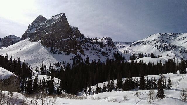
It's Memorial Day Weekend, looking at the weather all week at work drove me a little nutty.  Rain/snow at 40% chance in the Uinta's or rain at 20% south of Utah County.  Even late Friday I didn't have a clue.  I swung by an outfitter for a map of the southern Wasatch.  My target became anything off Spanish Fork Canyon aka Highway 6.  It's an hour, odd, drive and if I see a bunch of snow there I can day trip it and be comfortable.

The Great Western caught my eye.  I've searched the internet for anything on this trail.  It lacks, horribly.  I saw I could hike north or drive south.  I hiked north.  The GW isn't all hiking, one can go off highway vehicle style in many areas, hitch a horse, and even drive a car.

I turned in at a rest stop to check my map and sure enough I was 1/4 mile from the trailhead.  I thought about driving up the dirt road however, the first stream crossing looked more like a jeep adventure.  I chose instead to park and hike.

7 stream crossings total as I got on to single track dirt bike territory.  I followed up to Strawberry Ridge.  Thinking, so this is why my Dad likes to hunt around here.  Rolling hills, loads of sage and Aspens, perfect for a big buck.  By the way, he hasn't gotten a deer for a few years.

Knowing this is my first time out this summer, every mile I hike out, I have to come back.  This trail doesn't make any loops. I also kept an eye to the sky.

I stopped for water at Second Water creek.  It was the first good flowing stream in 6 miles.  The meadow looked good for camping.  I headed to Third Water Creek and noticed nothing but hammocking sites.  I'm on the ground this weekend.  I looked at the map, noticing there would not be much ground dwelling sites for 3 or more miles, I doubled back.

At the top of an unnamed rise, I dropped the ruck and took a side trail.  A top the mountain (?) I saw Mt Nebo to the south, Mt Timpanogas to the north, and potential communication towers in between.  My phone was in the ruck, arugh. On my way up I caught a moment glance with a bulk elk in velvet.

I took my time getting to the meadow noted before.  When I did I scoped a spot out and set camp, cleaned up and did some writing.  As I finished my supper of crunchy knorr side garlic noodles with a side of Caribbean spiced tuna, a couple of runners came up the creek.  It's 1 1/2 miles to the nearest road.

Besides a lazy afternoon, I set out a solar panel to recharge a device that goes flat just by looking at it.  This is a small hand held ham radio.  I scanned for any 2 meter contacts then for a radio station.  The first station was Local Satilite Christian radio.  I left it there and enjoyed some older radio worship tunes.

Tomorrow, I'll reverse my direction, put the sandals  (Xeroshoes)for the creek crossings and possibly head south, camping along the road side.

For now, I see a little gold on the hill above and pink in the clouds.  I ready for rain and more so to stretch out to sleep.

Tuesday, May 03, 2016

Bell's Canyon Falls

This is a popular place to come to, I have no idea why I am alone right now.  This is a quick hike, less than an hour, up one of the many front canyons of the Salt Lake Valley.  I'm sitting here trying out a new pair of hiking sandals, more like getting ready to tape a few blisters.  My feet stuck to the Xeroshoes material.  No mater, blisters happen occasionally.  Soon my feet will toughen up for more punishment.
It hit me late last night, I'm soon on another adventure in about 2 months.  I'll see waterfalls, mountain peaks, Alpine lakes, and hopefully meet some of the PCT thru-hikers as they've crossed over their 1100 mile marker south of Lake Tahoe.  Mean while, I'll be crossing my 65 mile marker.
I want to dream big, PCT big? May be.  For now, I'll hike my weekender stuff, hit a few 30 to 50 milers , and perfect not getting sore or getting blusters.

Saturday, March 19, 2016

Quick

Gazing at the view a head I glanced at the time stamp on my camera, I realized I'd been hiking for an hour and a half, winded, yes, tired, no.  I'd already reached my destination, of the beaver pond of Broads Fork of Big Cottonwood Canyon outside of SLC.  I hung out for a while using my snowshoes as a place to set my knapsack.
Three others on skis were grabbing a snack before they headed up a skin track to one of the chutes above.  Three others were nearing the top.
Years ago I chose not to get into backcountry skiing.  This area is wealthy to opportunity of terrain.  I'll add, too, avalanches.  From where I stood, I counted three recent slides.  Two of which are naturals coming off rock faces above, not from where someone would ski though.  The third was a wet sluff from a few warm days ago.  My route to this spot never crossing a run out path.  Broads Fork is nice in that regard.
On my way down I crossed paths with someone I've met several times before.  He's into mountaineering which will take him and his friends up through avalanche zones up to the peaks high above.  Later I crossed paths with another friend about a mile up the trail.
Arriving at the parking lot I glanced at the time, 11:20.  I'd been on the trail three hours, about five miles and 2700 feet elevation gain.  That was quick considering I had actual hiking boots on if I need to use the snowshoes and simply for being on semi punchy snow. Quick and well worth it this morning.

Friday, March 04, 2016

Spring update

For those who've expressed interest in my blog from work, thank you.  I know work is slow and it was while at work that I did most of my planning for the Appalachian Trail.

I will admitt over the winter I slowed down my hiking considerably.  I did get out, just not as often.  My most hiked trail was Dog Lake in Big Cottonwood Canyon.  It's quick and easy without a lot of avalanch danger.  Another hiked trail is the upper Millcreek road.  I do like Millcreek however it does get over run by doggie poo bags.  Please when you walk you pup remember to take the waste with you.  There are some things I will pack out, like campfire trash and candy wrappers.

My plans for the up coming hiking season is to thru-hike the Tahoe Rim Trail [TRT].  I'll get back up to Anderson Pass, this time with cool weather gear to finish King's Peak.  There are a few lakes in the Uinta's I want to get back to including Four Lakes Basin (south slope), Naturalist Basin (south slope), and Red Castle (north slope).  I'm not much of a fisherman, though I grew up fishing.  These lakes are remarkably stunning and will be worth the nine plus mile hike in.

The TRT is a quick 2 week hike with 3 resupply points wrapping around the mountains surrounding Lake Tahoe CA/NV.  At 165 miles some of it shares tread with the Pacific Crest Trail on the western side.  I first read about the TRT in Backpacker Magazine a few years back.  For it's short length it makes a nice, don't quit the job thru-hike.

I wanted to hike the TRT last year however, the temporary position I took at work made me hang the plans up for a season.  I'll say cyber-hiking isn't like tread on treadway, I managed.  I'll also say the position stretched me in ways of interacting in a training environment pushed this flip flopping intor/extrovert around in good ways.

I'll be digging up some links for the side bar, updating the photo slideshows too.  I may not do a GPS tracker except for a select few for saftey.  My tab pages are also getting a work over too.

As for now, look at the weather, toss on another layer, and hike on.

Wednesday, September 09, 2015

Henry's Fork

Henry's Fork, on the Uinta's North Slope is the quickest way into King's Peak, Utah's tallest mountain.  I'm not much of a peak bagger.  I like to hike.  For some reason I wanted to hike up to this mountain.

Two weeks ago some work mates stopped me from taking Labor Day weekend early.  This weekend I got it right.  I packed my ruck a little lighter then three weeks ago.  Base weight close to 10 pounds, add 5 for food, and 2 1/2 for water.  Close to 20lbs without sacrificing safety.

I monitored the weather all week.  Wind warning through Saturday morning.  30% chance of rain on Saturday afternoon and evening.  Clear the rest of the weekend with lows near 30 and highs near 50.  Not bad for the region and definitely weather mosquitoes don't thrive in.

I got up early, headed out, missed my turn which cost me an extra hour driving.  I also learned, local gas station help no longer know their areas.

On the trail, miserable hikers came down cussing the weather of the week.  Many for went going over to the King's Peak summit trail.  I stopped just after 3pm beyond Dollar Lake.  Way early however the rain came through in waves of short passing clouds.  The temp also dropped.

I pitched my little shelter.  Wandering in between flurries.  No snow but, did have hail one time.  That evening I met some fellow campers just up the way.

The night dipped into the 20's, my 20 degree quilt did fantastic, I didn't, I had cold spots.  One item I left behind was my thermal bag liner.  It's re-earned its position in my pack.  Same with my 1/2 litter bottle, aka coffee mug.

In the morning, I made 20 minutes from letting out the air in the pad to being on the trail.  I wanted to make coffee at the top of Gun Sight Pass.  Below the pass I changed my mind and left the pack.  Taking only some lunch and water, I headed up.

The wind bit through my rain shell.  I dropped into Painter Basin and around to Anderson Pass.  At the top of Anderson, I caught up with the guys from the night before.  A cold wind tore through me.  They offered something to eat and since I don't turn down trail magic, I ate.  They headed up the summit trail.  The wind and I were on other terms.

I rounded back the way I came.  Sat at Gun Sight for a while, now about noon thirty.  My secondary plan was to complete the Henry Fork loop and camp near Bear Lake.

The loop, amazing, okay, this whole region has me asking myself why haven't I been here sooner.  The south end took a little trail finding as I crossed several wet meadows.  The rest well defined.  At Bear Lake I found a great camp site however, it's too close to the trail and near a large body of water.  The later being the deciding factor as water equals colder nights.

I moved on.  The North end had no campable terrain.  The next area had no water.  Finally at Elkhorn Crossing, tired of walking all day and the time near 5:30 I sought out a place out of sight of the trail and in between live trees.  The area has hundreds of dead standing firs.

I got water, made dinner, and went for a wander.  The side trail I used to find my spot in the woods is an animal trail.  Hum, what else besides moose use it?  On my wander I did see a moma moose and a calf.

I watched hikers make their way down the main trail while I ate.  All were focused on the trail not in looking around.  I'm also just a few meters in from a huge meadow that stretches near a mile up into the valley.

The next day, I had an easy out.  I thought about  making coffee if I'm not super cold.  I checked the weather frequency and 30's with partially clear sky, light wind if any.

On the drive home I decided to re trace the route Google offered.  I got Googled. I retraced my route deciding next time to look at the maps and not rely on Google's directions.

Monday, September 07, 2015

The Rest of the Over Nighter

After wandering down by the lake with my supper, I returned to set my bed for the evening.  The Gatewood Cape affords a tight 7x3 space.

I soon found out reading while sitting is highly inconvenient, so is laying down and reading.  Before I knew it, I dozed off with the book in hand.  I quickly put it away when I woke 20 odd minutes later. I reached around adjusting a few items and returned to sleep.

Waking up periodically while in the backcountry is no different than at home, except I got stars right above me through the trees.  One time, a flash of lighting woke me seconds before the rain came.  I undid the button holding back the door, zipped it, and waited to see how the cape would hold off the rain.  It did just fine, less two spots that I'll seem seal another day and the fact that SIL, silicon impregnated nylon, lets a little rain through in the form of mist.  I fell back asleep counting flashes and booms.  Only a few spooked me close but, no closer the other outings.

In the morning, the rain leaving satter about, my gear nice and dry inside less two drip spots, I gave a good shake to the door and buttoned it back.  I looked out a while admiring the small meadow a few yards out.

I stuffed most the gear while inside the little shelter before making coffee and oatmeal.  My older canister stove never lets me down. This time I chose it over the alcohol stoves just for hot coffee.

As with the night before, I headed to the lake.  The stillness and the reflection of the mountain I will not share.  The camera stayed in camp.

A quick tidy up and I hit the return trail.  At Island Lake I stopped to dry out the cape.  It took only a few minutes.

On my way down I picked up trail trash which included a nice Gerber knife, not trash but lost.  I am amazed at how many little wrappers get out of hand.

By noon I hit the parking lot for an uneventful drive back home.  A few minor adjustments I may make next time out may include substituting base layers for the sleeping bag liner, a small alcohol stove for the canister, and taking a smaller camera.

This was a quick get me out for the night.  I'm glad I went.

This is now three weeks ago.  How time flies when one forgets to post.

Sunday, August 16, 2015

Kidney Lake, High Uinta's

The yearly metor showers gave me the perfect excuse to get away for the night.  Quite honestly, in content with sleeping right through the night. 

With the itch to get out, I needed a place to go.  Some how I got thinking about one of the hikes I took several years back out of Moon Lake, Duchesne UT.  Kidney Lake is about 9 miles in with around two thousand elevation gain.  Not bad for the Uinta's, actually very gentle.  This would be great.  If I did wake up in the night the lake is huge for the area and I'd have a big sky to look up at.

I picked through my gear.  I chose the Gatewood Cape by Six Moon Designs for the shelter/rain gear.  A new rain jacket to cover my light puffy of AT fame.  I chose an older canister stove and a titanium tea pot.  The crown 60 by Granite Gear came off the wall.  Loaded with my basics, 10 lbs.  My AT family's probably shaking their heads.  Wait theres more,  my toys include a decent camera, a book, and my 2 meter ham radio.  Now add 5lbs.  My food is 2 1/2 lbs and water brings my total to 20 lbs.  20 lbs is half the weight of my AT average.

I did get up early Saturday morning fpr the 3 hour drive to the trailhead.  On the trail by 9:30 I did a quick radio check.  No luck on the repeaters.  I did get the weather, 30% chance of rain this afternoon & night.

I made good time to the lake, arriving about 1:30.  Maybe I could'be slept in.  I've been reading and doing a little writing.  The afternoon showers dis not come and the sky is clearing.

I am pitched on the southern edge of a small clearing 50 yards from the northeastern beach.  Cattle will keep me company.  I haven't seen or heard anyone else.  3 or 4 groups passed by me headed back to civilization.

I'm grateful for the opportunity to hike in this day with a light load.  Dinner time...  Oh, this is instant spuds with tuna and some tea.

Saturday, March 14, 2015

Lake Blanche on Pi Day

An early morning wake up call, the setting still reads 'hike time.'  6:40 am was the time I set to wake up each morning on the AT if I wasn't already up.  Seldom did I have to use it.  This morning I set my site to get up to a favorite place, Lake Blanche.   I wanted to be one of the first there so I could enjoy the solitude, also to hike down on firm snow/ice packed trail.

About a year ago I turned in my two week notice at work.  It was the first time in decades leaving a job was my choice.  It's a decision I've not regretted.

The AT instilled in me and brought many other things to light about my dreams, desires, and personality.  The same people who expressed much concern and doubt are the same people who are amazed now that I kinda brush off the challenge as if it were nothing.  It was nothing but, a life time of weekend trips strung together in one continuous adventure.  Yet at the same time I'll admit there's a lot more behind it then that.  I like stringing the tale to others I meet on the local trails.   I find those who hike are more appreciative of the effort it took then those who don't.

As I sit here this morning, about 11:30, enjoying my hot tea.  I kook across the lake and see one of my campsites I've used for local overnighters.  I see the the Sundial foretelling the time of day.  Dreams of new adventures dance in my head.  Which long trail next?  Which trail will push me beyond where the AT took me?  How will I relate to the next doubters or employer who asks why?

I can't answer those questions today.  I just sit here enjoying the moment for this is the moment that makes the effort to get from there to here worth while.

Sunday, October 19, 2014

Maybird Gulch

I sit amongst the heap of boulders known as Maybird Gulch. It's a brief easy hike for me in Little Cottonwood Canyon.  What makes this hike nice is the lack of people.  Most on a clear warm fall day will head to Red Pine Lake.  In fact they share the same trail up to the last mile, then this one branches off.  This area reminds me so much of the White's in NH.  Mindful of course the altitude is over three times higher and a peak, the Phiferhorn, looms another 1000 above me.  An early fall of snow hides in the shadows.

A month ago today I entered Baxter State Park, Maine.  My 2,187 mile journey rapidly closing.  I've met many a person and shared with many friends about thus said journey since.  Many are congratulatory, others in disbelief.  Folks, though I'm an avid hiker here in my own back country, averaging 500 miles a year, I too am in as much shock that I completed the Appalachian Trail.  Several of my friends are just as passionate about the outdoors as I.  They shake their heads and say I could never do that.

Part of why I came up here today was to think about the many lessons of the trail.  First I want to apologize to the rocks of Painsylvania.  After hike to the upper bowl of Maybird they aren't so bad, atleast I had white blazes to follow there.  Another lesson was, I learned to be comfortable with being uncomfortable.  I woke up every day knowing my feet would be in some form of pain or discomfort.  I just found out I have flat feet.  No wonder I hurt while trying arch supports.  Being comfortable with uncomfortable isn't to ignore issues, it's more accepting that which is unchangeable while modifying that which is until it's no longer an issue.  Another important lesson is though I like to hike alone, I don't do life alone.  Simply put I enjoy community.  We are created to be involved with one another and not to be solitary creatures.  Not only as social creatures but also in the spiritual realms as well.  I enjoyed spending time with the Van Clain and other Christian believers.  As I've come back to SLC I'm enjoying getting back into a community of believers.  I found I need to nurture both my social and spiritual sides to remain balanced.

I'm finding the balanced lifestyle of the trail is a bit different to create at home.  It does take considerable effort.  That balance looks different now then before I left, and was different on the journey.  When I returned to Salt Lake I literally had to stop.  My my trail life is about moving forward every day.  If I wasn't moving, I wasn't making miles, if I wasn't making miles, I wasn't going to finish.   There were times I deliberately stopped.  I had to my body cried out for rest.  Now, I am getting reaquainted with friends and discovering not much happened.  Most say life is status quo.  Did this journey reawaken a passionate love of life I've suppressed?  Did I find a strength in myself I did not know about?  How now can I get this passion to be shared?  How can the estacy(sp) I feel be multiplied into the lives of others?

I am grateful to live in a metropolis so close to mountains of grandure(sp).  I am thankful for my trail family and my friends here.  The experience of the trail is beyond what I expected.  I shake my head in disbelief that I completed all the miles and do so with a mischievous grin thinking let's do it again or atleast take on another challenge to big for comprehension.   Let's find out together.

Friday, October 03, 2014

Statically Speaking


When I look back at the early days of my hike, this picture stands out as one on those that says, "The impossible can be reached."  Walking around the table we see: Jim and his dad Roger - aka Biscuits and Off Meds; next is Alison's Mom and the restaurant owner; Alison - aka Homestretch; Chris - aka Puzzle; Me -Train; and Slim - I never learned Slim's real name.  We were enjoying pizza in Franklin NC which is about 107 miles into our journey.

The Impossible:  We All Summited Mount Katahdin within weeks of each other.
  • Slim was first on Aug 28 according to Appalachian Trials web page.
  • Alison, sported a Super Girl costume was second on Sept 17, also seen on the same site.
  • Jim & Roger on Sept 19.  I met them at the Hunt trail head as I came into the area.
  • I was next the following day on Sept 20
  • Puzzle is the last of the group on Oct 1.  He txt'd me from town later that day.
According to the Appalachian Conservatory's site 1 in 4 or less successfully complete the journey with in one calendar year of their start date.  This year as reported and estimated 2500 left from Springer Mountain GA.  I was 1044.  My thru-hiker number in Baxter is 564.  

I hiked with amazing people.  I do check Trail Journals and Appalachian Trials sites to see who's made it.  I ran into only a few people the day before I summited and on my summit day as I came back into the trail head area.  Everyone has a back story. Everyone shared similar experiences in light of their back story.  We all are shaped by the story of our trail experience.


Just a few links
Slim: http://www.appalachiantrials.com/congratulations-weeks-appalachian-trail-thru-hikers-5/
Alison: http://www.appalachiantrials.com/congratulations-weeks-appalachian-trail-thru-hikers-7/

Friday, September 26, 2014

Things that Changed Along the Way

I'm a gearhead.  I'll admit that I like to play with things and systems to find what works and doesn't.  I'm always asking questions of other's, poking around gear shops, and reading manuals or reviews.  Along the AT journey I was no different.  My last week at home I changed my system based on a friend's recommendation, a former long section hiker, and along the way I changed several pieces of gear as well.

My pre-leaving kit was based on the Gosamer Gear Mariposa pack and a Kelty 20' down sleeping bag.  I had a homemade under quilt under a Dream Hammock hammock.  My stove was the Caldera Cone wrapping a Snow Peak 700 Ti pot.

The week I left I went to my go to of the Go-lite Pursuit pack.  It held a bit more then the other.  I dropped to the ground in a Six Moon Design Lunar Solo single walled tent with a Therma-rest Z-pad and went with a Hammock Gear 20' top quilt.  I kept the cook kit as is.

My first night at the trailhead in Amicolola State Park GA, I forgot to tuck my ground sheet under the drip zone of my tent and consequently flooded myself out in the rain on April 7th.  From then on I shelter hopped spending only three nights in the tent.  I didn't find the balance between ventilation and condensation.  When I asked Uncle Johnny , at his hostel in Erwin TN, what to do about that issue he replied, "Burn it, single walls don't work in the East." I took his advice and sent it home.  This actually was my second gear swap.

My first gear swap came as my Pursuit started to part at the shoulder straps.  I called REI and ordered a replacement.  Long story short, I ended up with my Granite Gear Crown 60 from the NOC, which remains with me and it never complained about who much weight I put into it.  One benefit to this pack is the hip belt can be swapped out for a smaller or larger size.  It can also take on the optional top lid, aka brain.  The Gosamer Gear and Go-lites have weight limits close to 30 pounds, after that they complain and or start tearing a part.  These are okay for the occasional day or so of 30 pounds plus but, don't count on longevity with the heavier loads.

My second gear swap, I've eluded to already, that of swapping out the tent for the hammock.  I got my original Hennessey Backpacker sent to me during Trail Days at Damascus VA. The original has a bottom entry and is single layered. Later, that weekend I bought the Expedition double layer from Hennessey himself and has a side zipper bug net.  My tarp of choice is the Hex-tarp from OES - Outdoor Equipment Supply.  It sets quickly and is compact.  For the White's, I went to the 10 point  cuben from Hammock Gear for the all around weather protection.

My third major swap out was for the stove.  The Caldera Cone is plan bulky for my set up.  I had an older canister stove sent out.  The max flame setting was larger then my pot base and the most fuel efficient setting took as long as the alcohol stove I just ditched.  I went to a homemade cat food can stove with aluminum wind break.  I found I used 3 ounces of fuel to heat 20 ounces of water.  Someone had a Flat Cat Gear stove/wind screen he liked and I ordered one.  When I got it, my fuel usage dropped to 1 1/2 ounces for my water requirement.    The Flat Cat requires two wires for set up, I lost 'em promptly.  I grabbed a coat hanger and made a new set.  So don't loose 'em if you get a Flat Cat.

My fourth change out was with what I wrapped up in at night.  I'm a restless ground sleeper.  My quilt great for the hammock not for the ground.  I developed a grab and tuck every time I rolled over.  In Damascus I also picked up my 45' sleeping bag.  I did go back to the quilt with my winter gear adding in a 20' under quilt also from Hammock Gear.

Along the way somethings just need replacing.  Foot wear is crucial.  I know of a few who did the journey in two pairs of shoes.  I did it in 4.  My fourth pair will see life beyond the trail.  Sizing is essential to get right for each pair.  Every time get the foot measured to ensure proper fit.  Just cuz one pair fit good don't think the next pair based on insoles fitting will be the right choice.  I did have two good pairs, Moab Ventilators by  Merrell, wear out in the heal padding around 500 miles of my usage though I stretched it out to 600 odd miles.  My third pair, Keens, wore out quickly with the multi rubber sole parting in several places among other wear issues.  I'm doubious if I even got a hundred miles before wear set in with those.  I left them in a hiker box. My fourth pair is back to the Moabs however, I used the previous insoles to size them. This was a mistake.  My toe width was different, it became wider as I hiked.  I should have gone wider or gotten a size larger.  The place I got them though had limited selection.  Limited selection meant I may not have gotten a bettet fit.  Still I should have tried sever pairs instead of just the one.  Thankfully, I only walked away with sore cramped feet.  Am I the only person who did not have to fight major blisters?

Clothing is something to be replaced along the way.  My first shirt wore out from the pack rubbing on it.  My red t-shirt I picked up from, of all places, a laundromat.  I forgot to take rain gear with me to wear when washing my clothes and asked the attendant if she had something I could wear, thus I got my shirt.

Socks are a highly debated clothing option.  We all found our favorite brand and or pair.  I started with a brand I hiked comfortablely with for years.  When they crusted up I tried Smart Wool.  They too crusted up quickly and wore out fast.  I finally tried Darn Tough, the only sock endorsed by the ATC.  I can see why.  They rinse out easily, take longer to crust up, and have re-enforcement in critical areas.  Simply put Darn Tough socks are darn tough, a high quality brand of socks.  I actually tried close to 5 different brands of socks.  My gagging factor is to wear the sock as long as possible without washing and check the performance.  Since I might do laundry once every two weeks how long a sock kept my feet comfortable without washing was the deciding factor.  Periodically, I'd stream wash the socks and air dry on my pack.  Steam washing, do so only down from the water gathering area and don't use any soap, rinse a lot only.  A better practice would be to grab water in a bucket or large ziploc and rinse away from the water source area.

I've made a lot of references to companies and specific gear in this entry.  I am by no means endorsing them or receiving any sort of compensation by them.  The expressed is strictly my observations and what I experienced.  Please take what I've expressed just as that, someone's perspective.  Your needs and requirements will be different then mine.  Please take multiple views into account if you are gear shopping.  My opinion, check in return policy, but don't abuse them, and play with the gear until you are comfortable with it. Better yet,  if you are new to long distance hiking or hammocking please try to get to a local event and ask questions.  At an event one will see different set ups whereas a retailer may not have the experience or many options needed for you to make informed decisions about crucial gear.

Enjoy and hike strong.

No Changes

As an admitted gearhead surely somethings must have not changed.  The smallest of items remained the same throughout the epic travel. I'll highlight some here.  I'll also admit I traveled heavier then most with a base weight of 25 pounds or more.  I liked being more comfortable in camp and getting good sleep over hitting big miles and being uncomfortable at night.  One will need to find their own balance the implied question.

I carried and used the same small Bic lighter the entire way.  I kept it in a small prescription bottle with some strike anywhere matches.  I started with and ended with not striking any of those matches.  A flick of the bic is all that's needed to get alcohol or canister stoves going.

I carried a small tube of petroleum jelly.  It backed up my anti-chafing stick when it ran out.  The alternate use is as a fire starter when rubbed on small sticks or onto cloth.

I also had bug dope and a headnet.  I used the headnet twice.  The bug dope almost as much.  I didn't like putting DEET on my exposed skin.  I did pick up some all natural Bug Band brand stuff and used it more to ward away ticks.  I didn't find Bug Band to be all that effective.  Somehow bugs didn't like me as much as they did others.  I think I leave with only picking off fewer then 20 ticks and swatting at fewer then a thousand mosquitoes.

My water system included the Sawyer Mini supplemented by Aquamiria drops.  The Sawyer is just a filter.  It's up to the user to find their own right way of usage.  For me I blew out the supplied bladders, squeezing water through them as directed.  I tried it on top a Smart Water brand bottle.  That too did not work cleanly for me.  I finally found a screw on adapter to hose at a hardware store and went inline.  Attached to a Platapus brand two litter bladder, I sucked on the outlet for my water.  I'd use the Aquamiria drops when I got lazy or wanted not to wait for the inline to drip into another bottle.  Aquamiria works best over time, taking up to 4 hours to kill off all bad stuff in the water.  The Sawyer does not kill viruses wherein the drops will over time.

These next items are what packed on my weight.  I carried a 8x5 notebook for a journal.  I'm on my third of the hike.  Yes, I did write every night.  A sample of my journal can be found on my Flickr page under AT Journals.  I did carry and use an Olympus TG 2i Stylus camera.  It worked flawlessly until the end.  As advertised it's tough, though, I found out on Summit Day not unbreakable.  I cracked a corner of the case and it had fogging issues on my last week.  For being exposed to weather for the last 5 1/2 months I'd say that's a lifetime of use for many non-outdoor folks.  My last heavy item is the Anker 12,000 mAh battery pack.  It met my weekly field charge needs between my phone, camera, and mp3 player.  With the large capacity plan on an 8 hour or over night town stay was needed.  The weight of these three items is over 3 pounds, weight I chose to carry.

My phone worked great as a blogging tool and camera back up device.  Though I did have to get a new battery as the original did not want to hold a charge. Electronic device batteries do have limited life span so check with the manufacturer for details or replace them before the journey begins.

I loved my Black Diamond Cosmo headlamp.    I used only two sets of batteries the whole way.  I only night hiked twice but was often the last to sleep 'cus I was writing.  Expect your usage to vary.

My camp shoes where Crocs, the basic ones.  As a gear hack, tie a loop of cord through two toe holes to make attaching to the pack easier.  They work great for town and shower shoes too.  I'd flip the shoes toe up for regular carry and toe down to carry a piece of fruit for a day or so.

I carried a small 500ml Nalgeen bottle.  Nalgeen's plastic is heat resistant so one can pour boiling water directly into it.  This became my hot and cold drink cup.  My spork found its home in it too.  It doubled as a foam roller when I didn't have one.  On the colder gloveless nights I'd wrap my hands around it.

If something is heavy one does not need to ditch it to loose weight.  Ask these questions: do I use this item daily? Does it work for multiple functions?  Does it simplify what I do?  My answers varied from time to time especially with the little miscellaneous items.  I finally ditched things like nausea meds, sun tan lotion, and sun glasses yet, kept the bug dope and Dr Bronner's soap.  With Dr Bronner's bounce a larger bottle a head or just get a little bottle leaving behind what's not used.  I carried half an ounce the entire way, preferring to wash items in town only.

What worked for me and what works next hike I'm sure will vary.  If you are exploring long distance hiking or interested lightening the load, don't be afraid to mix up the weekend get aways or find a local outing of hikers.  Lightening the load honestly comes down to experience on finding the comfort balance.

Enjoy and hike on.

Routines

For the last few months my days were near identical except for the scenery, weather, or towns.  They began often with a chittering critter either a bird or squirrel waking me around 5:45 am, my eyes pry open somewhere underneath my quilt to bark at them.  Then I sought benefits to change clothes, hit the privy, and pack.  Packing would include taking down the hammock, tarp, and stuffing my variety of sacks into the pack generally with the clothes and quilt bags on the bottom and food bags near the top.  Somewhere along the line I'd mix up cold instead coffee and swallow two packs of oatmeal.  Why not boil water for breakfast?  It came down to time and fuel.  I didn't want to take the time nor did I carry that much fuel.

Once all packed, I'd pull on the shoes.  Normally, I'd save what ever was wet from the day before to put on last.  As I began to hike, I'd grab a selfie, a couple of white blaze, and trail photos.  Typically, I'd finish the cold chug around a view point.  My snacks were within reach in either a side shorts pocket or pack pocket.  I'd eat two 500 calorie snacks before lunch.

In the South, I often skipped lunch but, found that when I did eat lunch my energy levels would remain high.  When I recognized this I began scheduling lunch and making larger miles per day.  Lunch would generally be at a shelter or view in or around noon. I'd pull out my blue dry sack which held peanut butter and flour tortillas.  Not much for lunch but two or three rolls.  Occasionally, I'd have an extra power bar, shake on cinamon, or cut a chunk of cheese.  The harder cheeses last longer then the soft cheeses without refrigeration.

A snack sometime in the afternoon would happen around 3 ish and I'd be good until camp.  In the North, I lost my evening hunger so I made sure my last snack happened well before an hour I made supper thus ensuring I'd be sufficiently hungry to choke down what I prepared.

At camp, I'd first locate two trees about 12 feet a part for the hammock by holding out my hiking sticks.  Anything closer wouldn't do, much beyond not either.  The closest I hanged wad 8 feet and the farthest stretch close to 25 feet. I'd then start either by putting up the tarp or hammock, weather depending.  Once this is set, I'd gather water and clean up.  Finally, out came dinner.

Dinner, oh no!  This is one thing I will plan out a lot better.  Dinner is a Knorr pasta, rice, or potato side.  Occasionally, mac and cheese.  I preferred to cook in the bag and add stuff to it.  My most common add in is tuna packet and garlic.  For the mac and cheese I add a small amount of instant potatoes to thicken and help cook the noodles.  Cooking in the bag eases clean up, there isn't any besides licking the spork.  With boiling my water, I filled my pot to the brim.  I always made tea.  My tea got first dibs on the water.  My tea of treat is Egyptian licorice herb tea.  My least favorite is chai and green teas. I used untreated water so bringing my water to a boil, essential.  My fear with mashed potatoes was creating Albert potatoes.  Albert was a cook of mine on the Caribbean Mercy who once served dry & lumpy instant potatoes for dinner just before I left in '01.  My other dinner fear was noodle soup.  Since I cooked in the bag I didn't pour off the excess water and would add instant potatoes to thicken.  At the end of the hike, I stopped carrying extra potatoes and just drank the slurry.

After supper, I'd start to write in my journal.  Chatting around the shelters happens around supper time, at a campfire, and my favorite, breakfast.   The more involved with conversation the more chaotic my journal entries are.  I read a recent issue of Backpacker Magazine that stated quiet time is 10pm.  I'm sorry to report they are wrong.  It's hiker midnight or whenever it gets dark be it 6:30pm or 9pm or whenever hikers start to bed down.  Headlamps are often donned around the same tim as dinner prep is underway.  If you want to cut conversation short keep shining it in someone's face.  I ended many a conversation when someone put their lamp in my eyes.  Please wear it around you neck and dim it.  You'll be surprised with how little light is needed to move about.

When I stayed in the shelters my daily routine was the same.  As I passed shelters I photo logged the shelter books.  I began this when I looped back.through the NOC and wanted to record what my friends wrote about the experience of cold wet days from there to Fontana Dam.

In town for resupply I started off with just buying stuff hopping I got what I needed.  I found myself over purchasing.  Tim, another thru-hiker, who also had another long distance hike under his feet, introduced me to the gallon bag system.  It uses a bag for every day.  It worked.  I'd place a dinner, all my snacks, breakfasts, and drink mixes for the day including the instant coffee.  Only once under this method did I run out of anything and happened to be coffee packets when I got out of sync.  I left out lunch as it never changed. If I had less then half a package of peanut butter or tortillas I got an extra.  I did at one time carry pb over a hundred miles without so much as taking a spoon full to eat.Once I figured my meal plan out I stopped over spending and leaving so much behind in hiker boxes.

I found my daily routines an essential part of the hiking experience.  They helped me cut time in leaving for the day, forgetting/loosing things, and falling into sync with other hikers. With the amount of stuff I carried, the systematic approach worked.

I will say my time from wake to gone, less privy and breakfast, was close to half an hour if applied.  I'd like to cut it to 15 minutes.  To do that means for me to cut comfort somewhere.  The shorter time to gone translates to less exposure to bugs, cold, or adverse weather.  When I'm moving these things are less irritating.

Decompressing

Some may call it 'reentry', others 'reverse culture shock', others 'getting back to reality.' What ever one calls it, I can say it's a shake up of the senses.  The TV's flash splash at every juncture.  Speakers vie for attention of the ears.  Horns honk to the unaware like me.  Creatures of upright stature, all shapes and sizes, jockey for position.  A reversal of getting away from this all of modern living that happened 5 1/2 months ago is taking place.  My head doesn't know what to do.  I'm already missing the simplicity of trail life.  I'm caught in a whirling mass of sensory overload.  My ears long to hear the chatter of a squirrel.  A long time ago I wanted the presence of of traffic's hum to lull me asleep.

Staying true to exploring the country, I am taking the train out of New England.  To be honest and open, I didn't plan on getting this far.  I didn't plan on finishing.  Stastically less than one in five complete the Appalachian Trail each year.  I figured I'd be in the other four not be the one who finishes.  Can I say I'm successful at failing?  I planned something so huge I knew I wanted to do but didn't think it was possible.

I initially wanted to see how far I could hike.  Then,  I wanted to see who's inside this shell I've become.  I wanted to push myself beyond myself.  I wanted to get out of my comfort zone and experience something beyond.  Yes, I backpack and hike often but, never to this extent.  I can head out and come back as I please.  Once on the trail reaching Mount Katahdin became more then a mark on the papers I presented to everyone.  Reaching Mnt K became not a destination but a starting point.  When I worked in the 'Glades ( winter of '91 & '92) I'd stare at the horizon and think 'what's on the other side for me?' Mnt K's became that new horizon for me. 

The day I climbed that mystical philosophical mountain couldn't been better.  A hard climb that I danced up.  The wind reminding me of the unseen challenges.  The mist clouding the view showing me the beauty of the challenge upon arrival.  The summit, not ideal, nor clear as others wanted that day.  For me, perfect for my ending and new beginning.

With not having plans to leave New England, I winged it.  From the AT Lodge in Millinocket I caught a shuttle to the bus, fom there into Boston.  In Boston I had a 15 hour lay over so I asked around and got a number for a local hostel, Friend Street Hostel near the Garden's.  Now, I'm on Amtrak headed West.

Winging it is possible for the AT, though not recommend.  There are great resource planning materials on WhiteBlaze.net  I recommend downloading Baltimore Jack's resupply guide, updated in 2007, a bit old, it's close enough.  For mileage hikers check AWOL's Guide.  For landmark hikers get the set of maps from the ATC.  I used a combination of all.  I also did a lot of reading on TrailJournals.com and read personal blogs now like mine.

Getting experienced with your gear and knowing how you hike will be the best preparation you can do.  It took me a while to refine my gear even while on the trail.  It didn't help that I swapped out major components right before I left.

This extra time I'm spending on the train is giving me time to sort out the experience.  I've met a lot of folks some who have no clue about the outdoors to those who are well experienced.  Swapping stories and talking with them is helping me to figure out what is expected from others.  It's helpful to know which stories help me tie this trek into relatable clips.

I am reading comments on this site and within my social media content.  If there is something someone wants me to expand on please drop me a line.

I want to give a special shout out to some for their encouragements along the way in specific settings.  First to Hobs who found me at a hostel near Harper's Ferry.  He came out and gave me a pep talk when I seriously considered getting off trail for knee issues.  He encouraged me to do whatever needed to keep going forward.  Thanks to him I am looking at my summit photos as well as my trail family's.  Next to Jenn, who kept a wall map at work and tracked my progress, keeping the team up to date on how far I've gone.  Ross, also from work, who let me know he followed closely.  For the Van Clan, who adopted me in prayer and provided some encouragement along the trail - Oreo's have taken on new symbolism.  My parents of course need a shout out too, just cuz.

Literally there are to many one of encounters along the way that propped me up when I was down to name them all.  Some of these became stories I tell, others already fades away.

Over the next few days I'll stare out the window, try to catch naps, and review what I think are important highlights.

I can't believe I failed at failing.  Now that's a huge confidence booster.  What's next to take on?  Jokingly to Jimmy, who was doing a sweeping video interview, "the CDT in'19." Hum?

Saturday, September 20, 2014

Summit Day

Waking long before my alarm rang '10,000 Reasons' by Matt Readman, I git restless.  The morning chill hadn't set to yet.  I tried to con myself back to sleep.  I couldn't.  It's summit day.  A day I'd look forward to long before setting foot on Springer Mountain GA 165 days ago.  I gave in.  I got up.  I packed with a chilly top in mind and lunch to eat in the go.

I left my crown 60 at the ranger station and used a borrowed day bag.  Loads of day hikers were at the Hunt's trailhead making their way up.  They'd never understand the emotions I hit: joy, elation, anger, pain, joy, elation.  Some gave me congratulates as I passed.  Many huffed and puffed up the trail.  I danced.

Along the way, I finally finished my coffee before hitting the tree line.  The wind kicked up a little at tree line.  I tugged a jacket in.  Above the tree line the terrain went from steep to even steeper.

Thr hardest trail on the AT?  Gecko no!  Don't believe the guide book that elevation chart lies.  The hardest part is still, for me, getting to the AT in Georgia.  The hardest trail I've ever hiked is Lone Peak in the Wasatch.

The trail began to require hands on the rock and in one part, a rebar hand hold.  I feared it but, in reality, easy, no worries up or down.  A mile of this class 3 climbing and that was over.

I hit the Table Lands and a mile less, Thoreau Spring.  The spring, iced over.  The emission kicked in again.  The trail reminded me of the White's.  Into the mist I hiked.  Passing more day hikers.

At long last, the a frame sign.  I busrst into tears.  I cried my self to sleep after my sister passed away but, not at her funeral.  I cried the joy of this accomplishment, over whelming, openly.  I handed my camera off to a hiker and asked him to take pictures.  This us my moment if AT glory.  I was the only Thru-hiker there.  The wind fought me as I got on top.  The mist swirling around.

Moments later I tucked in behind rocks to wait for others and for the wieather to break.  Bison and Kozi came 1/2 hour later.  I'd run into the Pope and his group to.  Jolley I saw 1/4 mile down from the top.  We are AT Thru-hikers I yeld at him.

On my way down, inching against the wind, even down thru the toughest steepest sections.  I fought the emotions.

At the trailhead, I made one last White Blaze pose.  I leaned against the tree, knowing this is the last few feet I have on the AT.

I heard a familiar voice, GunPowder of the Van Clain.  I ran and gave her a big hug.  The Van Claim will go up tomorrow with the Von Tramp family.  They showed up too.

My trail family, seeing my friends yesterday and today.  I grabbed photos of many.  Completors, finishers, thru-hikers.  What a feeling.

I found a ride into Millinocket with some day hikers and off I went.  I write but the writing doesn't do much.  The high of this accomplishment lingers and yet hasn't set in.

To all who follow this journey and those I've met along the way, thank you.  This is a journey not taken a lone.  Though I hike a lone, I travel not a lone.

100 Mile Wilderness

The 100 Mile Wilderness is not like what I think of out West: desolate, empty, vast.  It is actually busy with road crossings, abundant with lakes, and active with many uses. 

For me, it is the last hurdle in this epic journey.  It has mountain ridges to traverse, bogs to cross, and miles to move.  I don't like hiking dawn til dusk but, to pull in 20 mile days that's exactly what I've done.  Daylight is gone by 7:30 pm.  I've traveled much of this alone.  I found myself between hiker bubbles, again.  I've grown use to this.  I still prefer to hike alone yet camp with others.

The terrain in the guide book may show flat.  Don't let flat mean easy, some of the easiest is the up an down.  The rocks and roots give way to mud.  Bog bridges are often rotten under foot or moisture soaked. They can be slick traps over mud knee deep.

Did you know Maine is another word for wetland?  I'm joking, the land of Maine is truly stunning and words nor photo can describe what I see.  Next time I come I may sky blaze (take a plane) a section to view the many lakes I've hiked around from above.

The 100 Mile Wilderness begins at Monson and ends at Abol Bridge.  Monson a small town on a lake with two great hostels and an even better bakery, Pete's Place.   Abol Bridge a small convenience store with grill in route to Baxter State Park.

In this region, I've caught glimpses of Mount Kathadin.  I've watched the mountain go from a blue lump on the horizon to seeing defining features.  As one reads this, I'll be on Mount K celebrating this journey's end.  This journey is hardly over though, I believe it's just begun.

Last Night

The last night on the AT.  I can't believe I lay here listening to a few fellow thru-hikers talk by a crackling fire.  The Birches are the only designated shelters for us and space is limited to 12. Of the guys only one I've hiked with over several weeks, Jolley Green.  I met him in Dalton MA.  The others: Pope, Cruise, Potatoes, and Muffin Man, I've met since the White's

I signed the final registry as hiker 564 from GA.  This is only thru-hikers not any alternative style of hike.  Crazy, less then 1/2 my original thru-hiker number.  Where did everyone go?

As I made dinner, To Long - Sara, came thru.  She summited today.  She'd seen my entry in the Trail Log and came over.  She's trail family.  I've known her since who know's, Georgia?  Probably.  Good to see her one last time.

As I came into this area I caught another face, Forget Me Not.  I've known her only a few weeks.  While talking with her, Jim.and Roger aka Biscuits & Off Meds, came into sight.  I've hike consistently 1/2 day behind them for as long as I've know Forget Me Not.  This son & father team I've known also since Georgia.

We've made it.  2187 miles and a few more for good measure.  Each set out on this journey for a different reason.  I've forgotten why I came out.  I love to hike and see new places.  This hike's taught me a lot about myself in ways I can't put into writing.  One day I will try. 

Friday, September 12, 2014

I Slipped

Knowing I had two fords today, Sept 11, I knew I needed to exercise caution.  I like to take a lot of photos along the way and this day happens to be a rare wet day.  This year's journey is dry compared to previous years.   As I paused to look at the route across the creek, Moe river like, I lost my balance and ended up butt on the ground, feet ankle deep.  Problem solved, I picked myself up and waded across.

Two miles later, the fording, a bit different.  A wider and swifter river.  The rain added a little to the flow.  I pondered if anyone was around.  I whistled and got a response.  I put my SPOT beacon on my belt and turned it on just in case.  I loosed my straps and made sure my hip belt was not fastened.  A rope stretched between the shores.  I looped my poles over it.  My footing , not great but since my boots were already wet, I didn't bother taking them off.  I made the far shore without issue.

I tracked a few more miles for the day without further worries.  I was glad to see a few friends at the Horse Shoe Shelter.  I found a place to set up and dried off.  The slip did leave me muddied but the trail was misfired with the rain of the day.

Sunday, September 07, 2014

200 miles left

As I crossed over Sugarloaf Mountain, I passed the 200 miles left mark for this journey. 

I knew dropping into the cirque the rest of the journey wasn't going to be easy or may be that was for today.  I couldn't tell at the moment as the weather turned from okay to let's put wet on the ground.  I stared into the mist.  The trail guide said steep.  Ha, steep, I've seen that plenty.  What made this steep, steep was the lack of granite slabs.  It was rocky, wtf kind of down. 

I learned several days ago if you find a switch back in New England count yourself blessed.  In Maine a switch back is a frightening down, followed by some sort of traverse with a little up, then back down again.  This wouldn't be so bad of frightening if I didn't have 40 odd pounds on my back.  I think this kind of terrain is fun with lighter loads.  I'm committed at this point, no backing out

Next time I'll, is a common thought as I've refined my gear dozens of times in my head.  200 miles left, will I take the time to refit my ruck as I envision?  Will I begin to plan the next big adventure as many in Georgia wanted to?  Hey, where are those lofty dreamers?  Did they make it this far?

My knees gave way to gravity spills as the rocks seemed to distance themselves farther a part.  I groaned trying to figure out poles or hands.

Eventually, I made the 1100 foot descent in less then 7/8ths of a mile.  The stream at the bottom needed fording.  A Q&A sheet at the last shelter said Maine AT Clubs don't maintain bridges as ice jams in the spring often take em out.  A plank with a fat wire lay across the gushing gap.  I placed one foot then the next.  It held.  I wouldn't need to find an alternative today.  I shuffled my feet, the plank bowed and held.

200 more miles, hum?  What else does Maine have?

Friday, September 05, 2014

Rangeley ME

I haven't seen a mythical beast of Maine yet, better known as a moose but I have seen the line between the equator and the North pole...